>Translated with www.DeepL.com/Translator
(>Pictures at the bottom!)
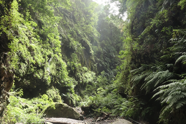
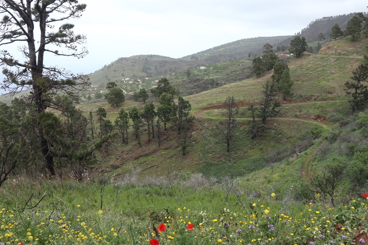
This island, far out in the Atlantic, is the greenest of all the Canary Islands. In the north are lush forests that stretch far up into the mountains, while the south is dry and volcanic activity is still active to this day. In 2021, an entire stretch of land, a village with its agglomeration and extensive banana crops west of “Cumbre Vieja” were buried under lava and ash.
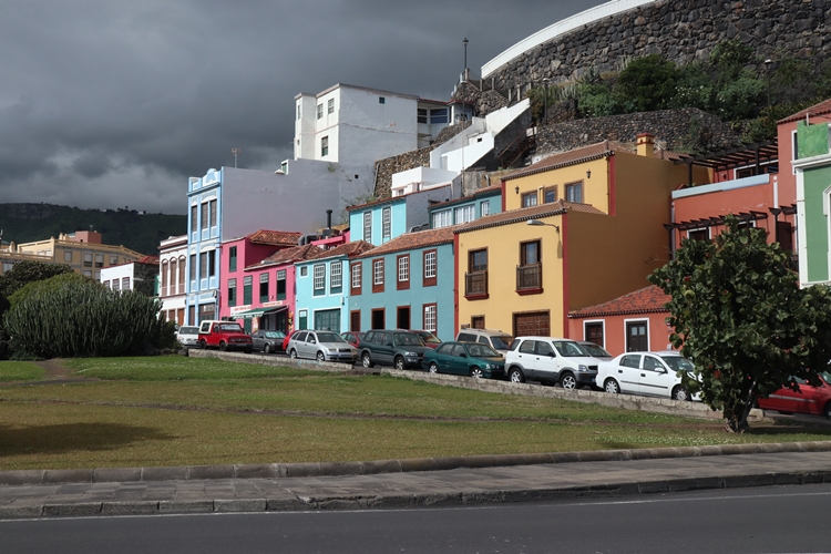
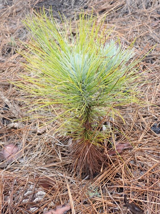
In former times, i.e. in the times after the discovery of America, La Palma was an important place, and the Canary Island pines also provided the best wood for shipbuilding. Trade, special laws in connection with the Atlantic crossing and the former sugar cane cultivation brought considerable wealth to the islands and its inhabitants, which can still be experienced today in Santa Cruz de la Palma and other places.
Today, things are a little quieter on La Palma than they were at the time of the great voyages of discovery. Since there are hardly any beaches with mass tourism, you can quickly find your peace and quiet on the extensive network of hiking trails or get lost on some forest road.
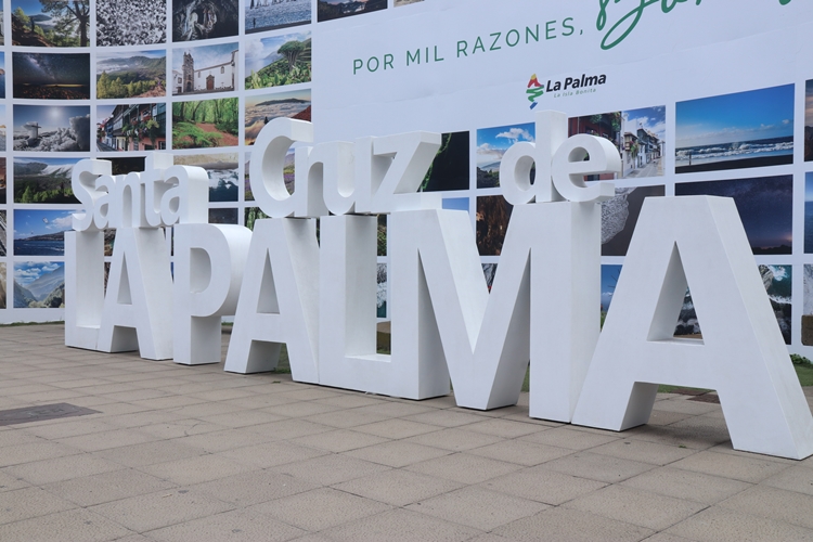
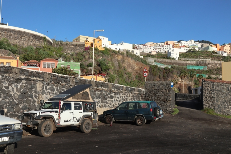
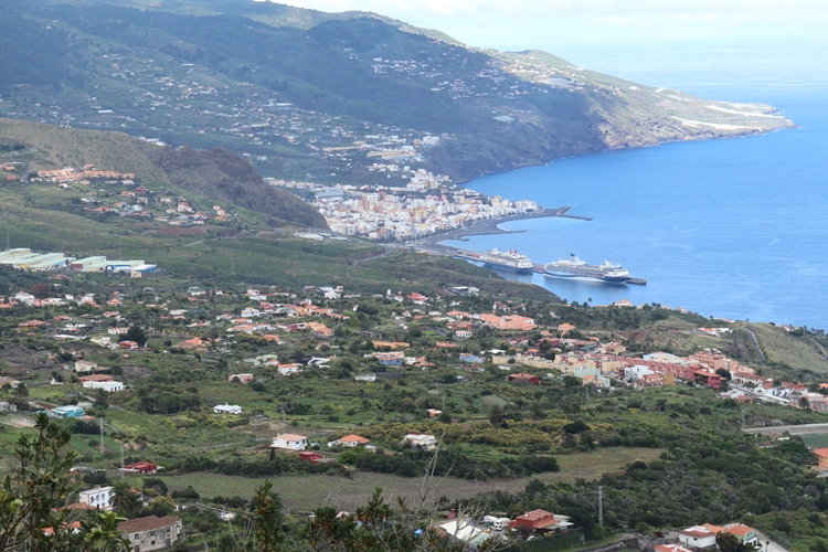
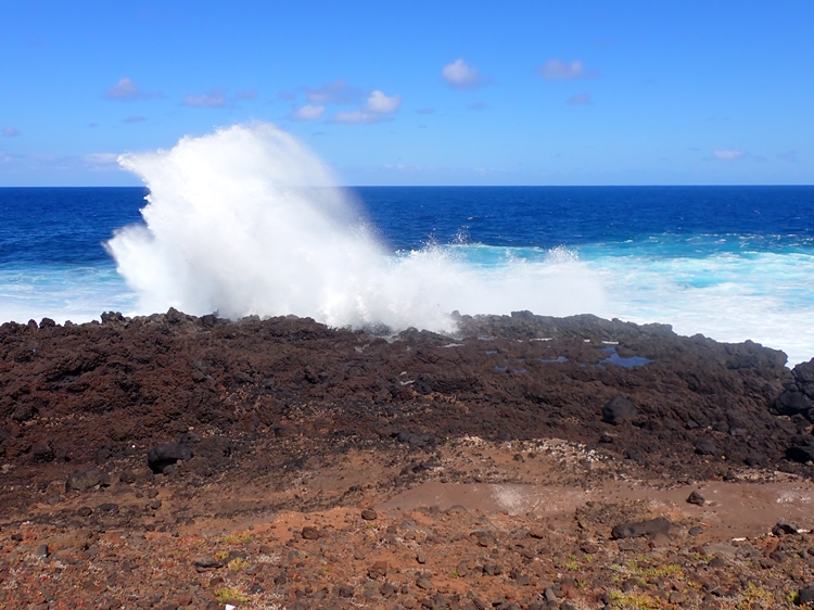
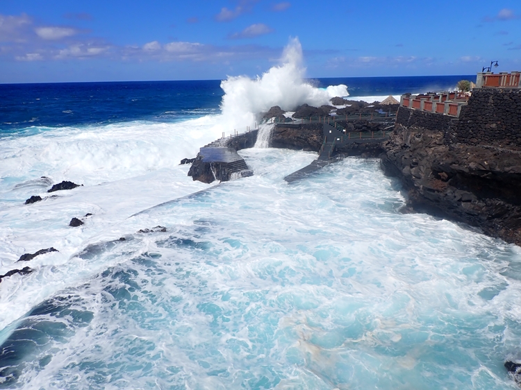
Late in the evening, it had already been dark for a long time, our ferry docked in Santa Cruz de la Palma and a short time later we were almost in the middle of Santa Cruz, which immediately made a manageable impression on us. Thanks to the “Park4Night” app, we knew where we could park for the next few hours: A short time later, we were standing between a part of the old city fortifications and the surf in the immediate vicinity of the centre.
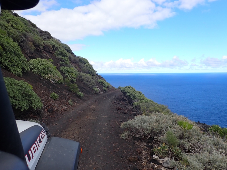
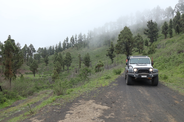
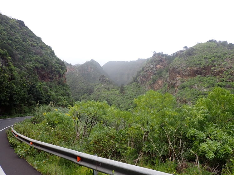
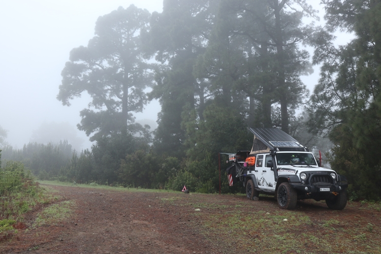
The anticipation of the new and for us last Canary Island we were heading for was great. We were excited about our further adventures. But we already experienced the first disillusionment on the second day, when we wanted to drive into the interior of the island via a side road. The way over the northern foothills of the “Cumbre Vieja” was still not passable due to last year’s volcanic eruption and we had to, willy-nilly, choose our way to the visitor centre via the expressway. At the information centre for the national park, we were given additional information about the traffic restrictions and what we could and were allowed to drive on this island. Many roads and forest tracks in the centre were still under a thick layer of volcanic ash and were not allowed to be driven on by recreational vehicles. Oops! So we returned to the east coast, then meandered along almost unrideable roads towards the southern tip of La Palma. On the flanks of the “Cumbre Viejo” the clouds hung thick and tenacious, but down by the sea the fresh north wind provided sunshine and let us choose ever “crazier” routes. And, also on this island, it often goes down the fall line towards the sea and often made the brakes glow.
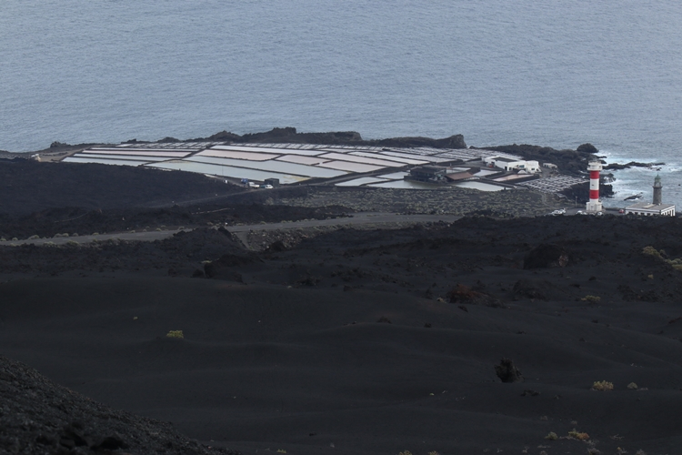
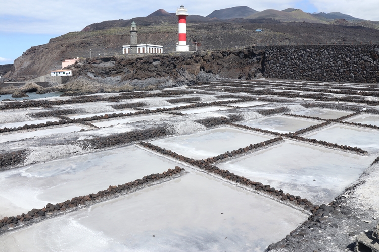
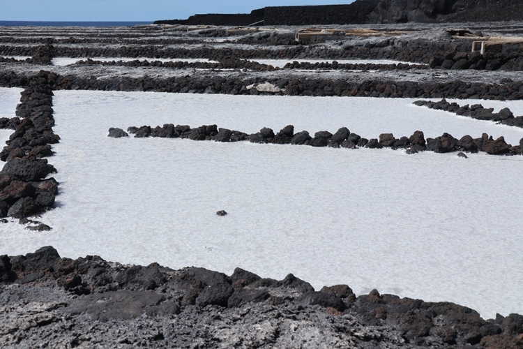
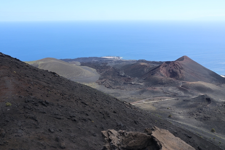
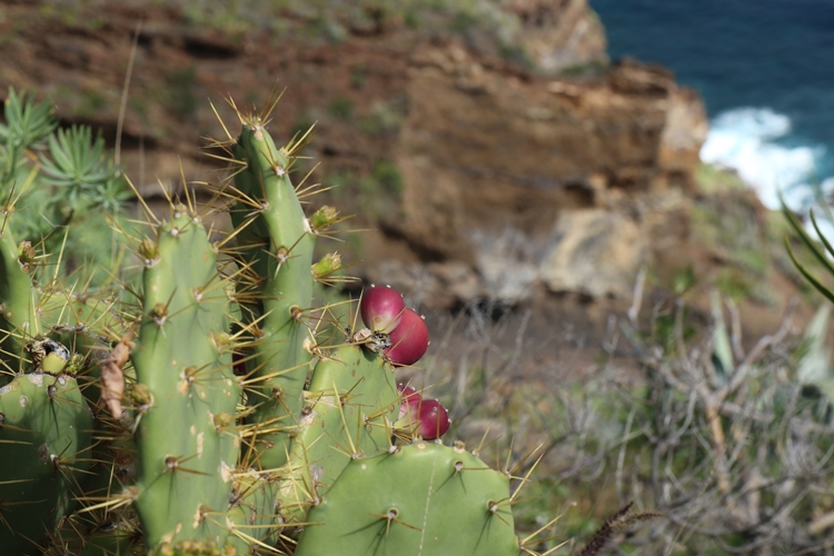
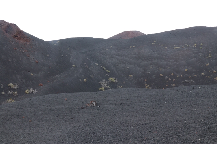
In 1971, it hissed and cracked at the southern tip and the “Volcán de Teneguía” was born. It left behind a stone desert and covered large areas with volcanic ash. We liked the southern tip of the country right away and took our time to experience as much as possible, especially as the weather outlook in the north and at altitude was rather poor and we could expect somewhat drier conditions at the sea.
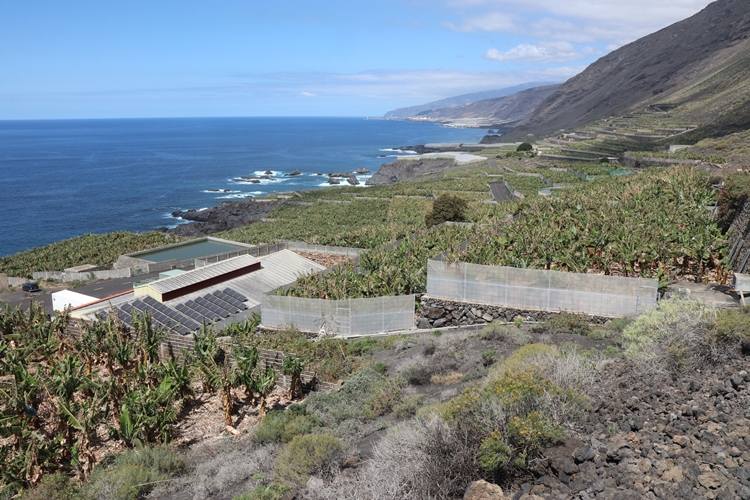
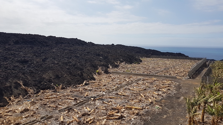
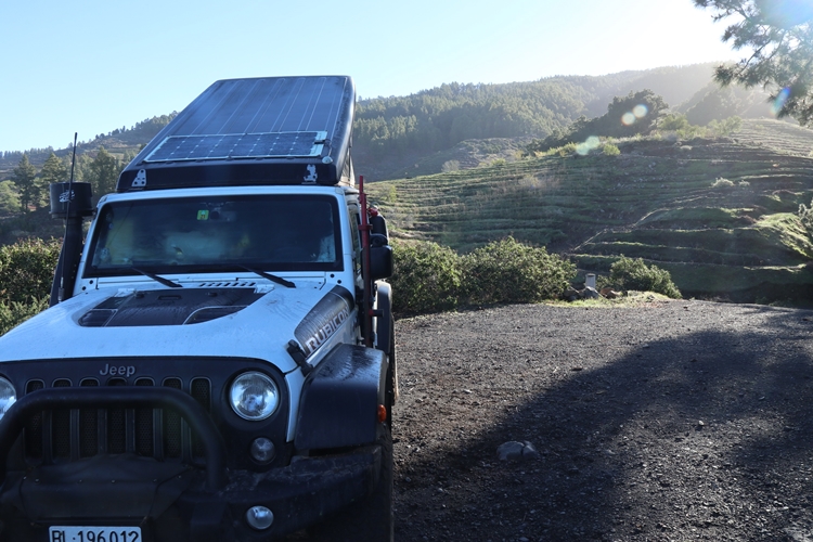
After visiting the salt mine of “Fuencaliente”, we dared to drive northwards along the west coast, knowing that at some point the road would be blocked and we would have to turn around again. The earlier volcanic eruptions not only favoured banana cultivation by providing excellent soil, but also gave the island an ideal topography. Thanks to the available water, banana production developed into the most important economic sector after sugar cane cultivation. Today, one monoculture after another can be found on the west coast. If the terrain is too steep or too high, huge vineyards are cultivated instead of bananas and the juice is turned into delicious wines.
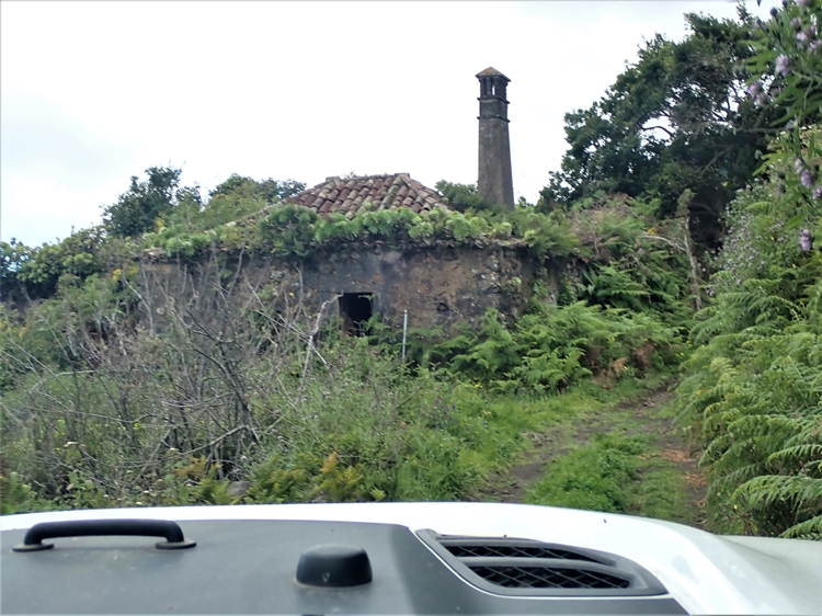
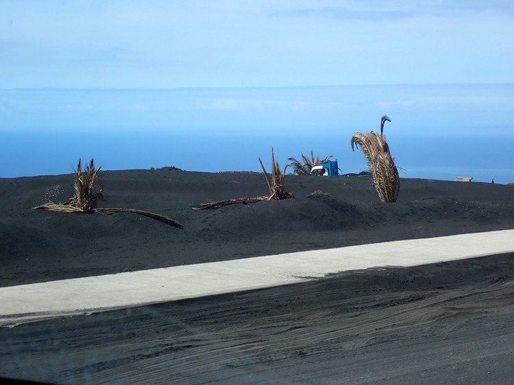
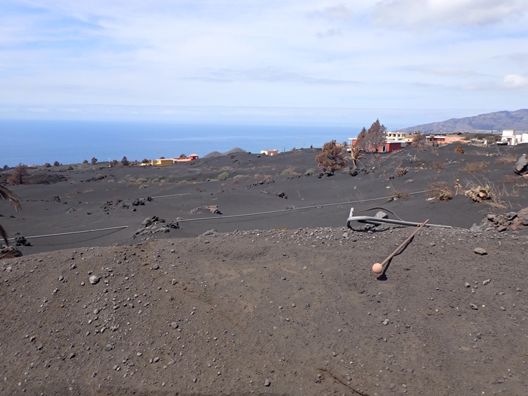
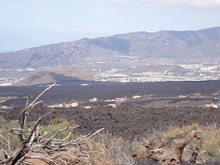
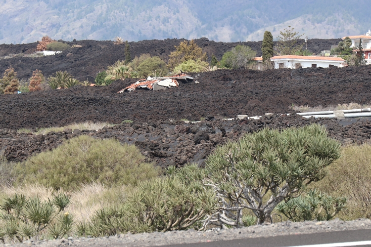
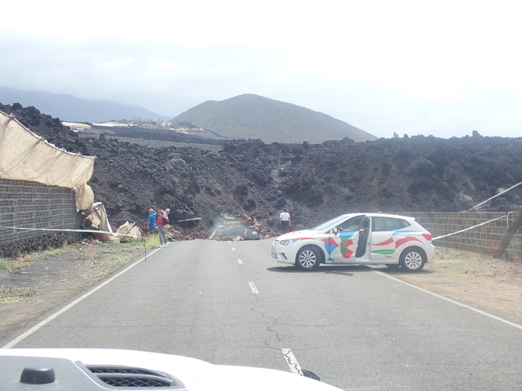
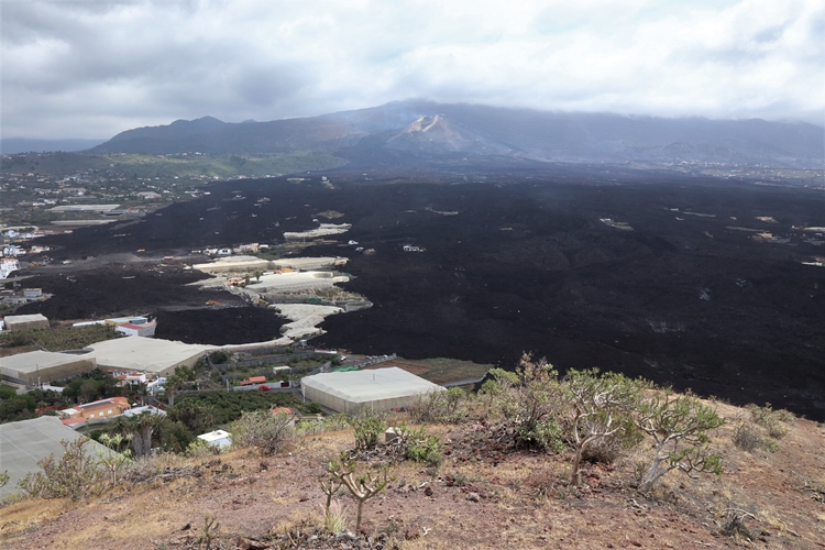
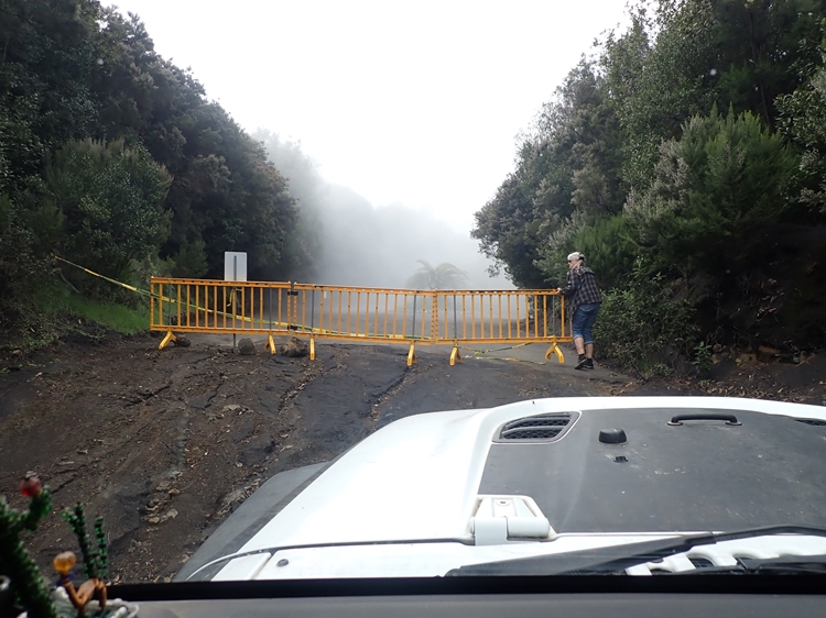
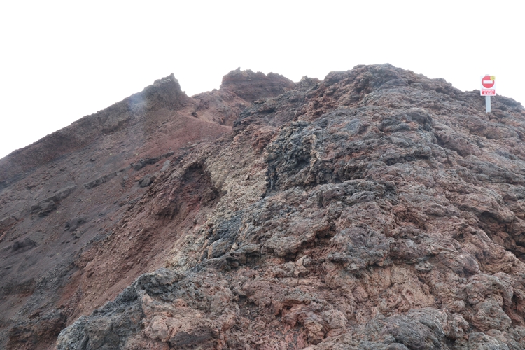
On our way northwards, we soon discovered a jet-black mountain in the middle of an old mountain flank. Construction machines were everywhere and many people were busy with cleaning work. The closer we got to the solidified lava field, the bigger the clearing machines became. Countless small trucks were transporting volcanic ash to a depot, from where all the ash was taken away in huge trucks. Only now did we see the extent of last year’s volcanic eruption and that nothing will be possible here for the next few years. Besides the extensive banana plantations, a whole village with its neighbouring settlements disappeared and only a few things of human origin can still be found in the black-brown rock. At a check point our journey came to an end. We couldn’t get past the “Guardia Civil” without the appropriate papers. Somewhat depressed, we returned to the southern tip. Although there were no fatalities during this outbreak, this event must have left deep scars on many of those affected; almost all of them lost all their material possessions.
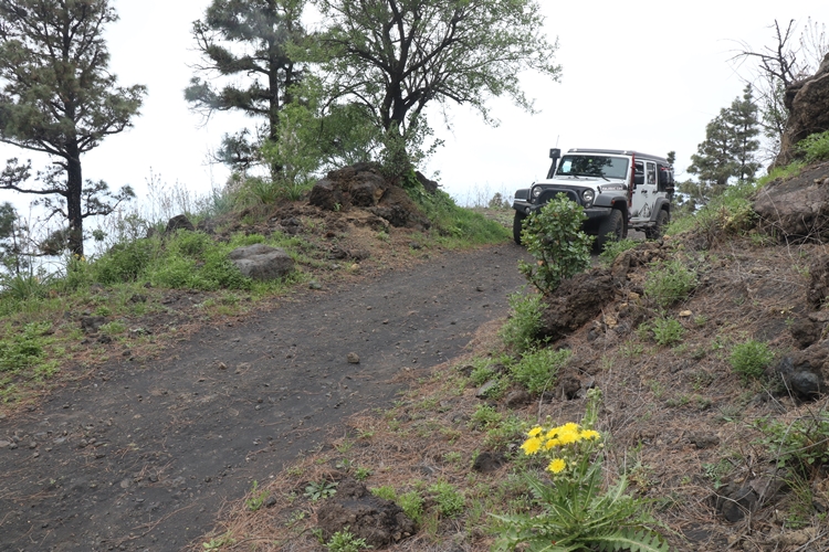
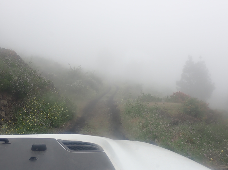
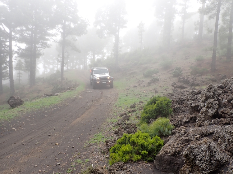
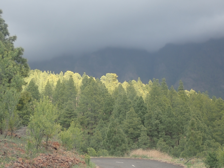
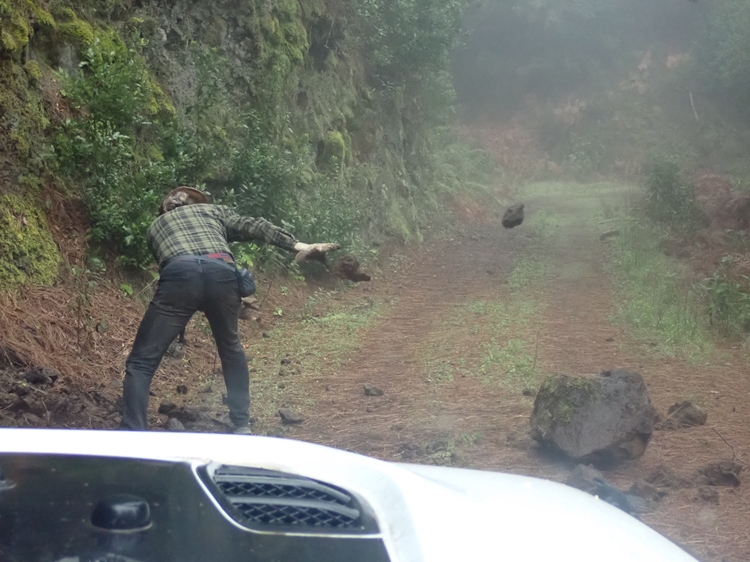
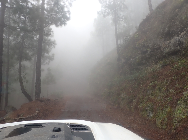
On the way back, we climbed – we still don’t know if it was allowed or not – westwards along a forest road towards the “Cumbre Vieja” and encouraged us to also follow the ridge northwards along forest roads eastwards. The following day the weather was rainy and so we drove almost alone northwards through the misty pine forest. We could count the encounters on one hand, even though it was Saturday and the local population loves and appreciates the “outdoor life” above all else. We kept expecting motorcyclists to meet us on the narrow path in some bend, but apart from a mountain bike group, there was no one on the road.
In the afternoon we knew why: Suddenly we were standing in the middle of the restricted area, where no one dared to pass through the barriers. Secretly we sneaked out of there again and continued our way 😉
South of the national park “Caldera de Taburiente” we parked in a car park and hoped for sunny weather for the next few days. Unfortunately, this wish was only partially fulfilled, and we were only allowed to experience a short hike at the “Cumbrecita”. The rain clouds hung too low for further hiking excursions and a strong wind scurried across the mountains. Instead of lacing up the hiking boots again, we spent the rest of the time with lake sightings behind the windscreen.
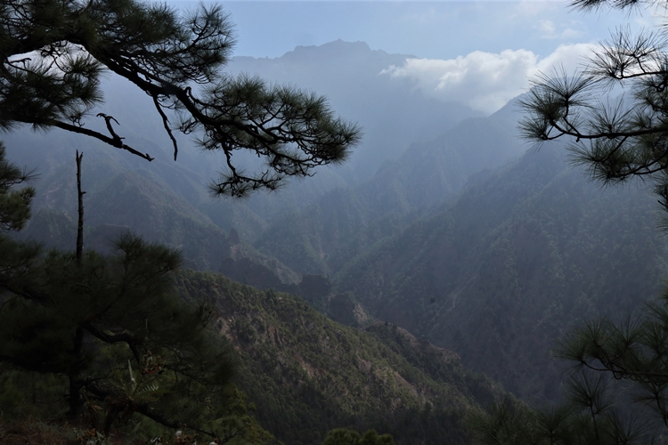
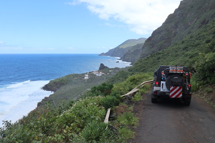
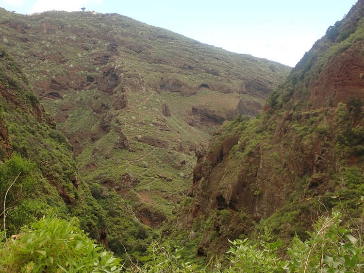
Besides the lava river, which we visited briefly to the north, we climbed further northwards over countless mountain ranges on the west coast. Again and again, we explored steep spur roads down to the sea.
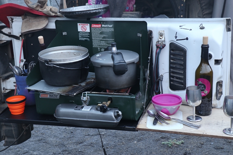
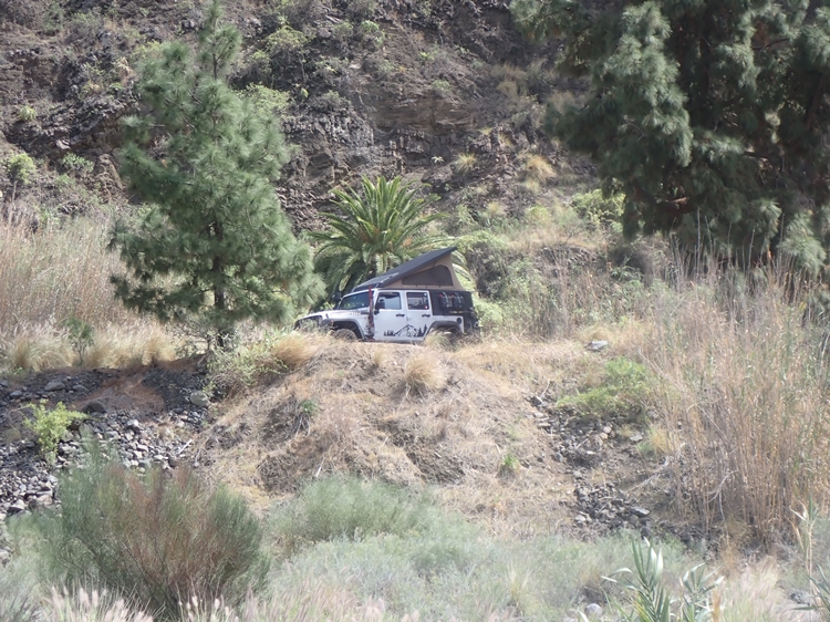
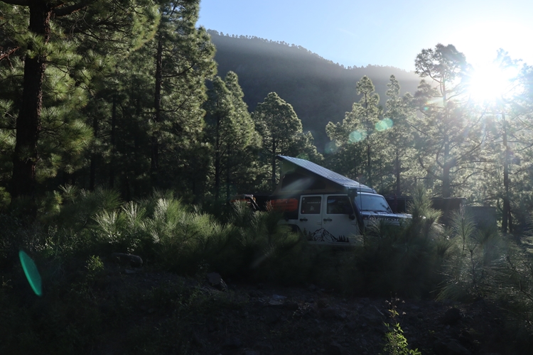
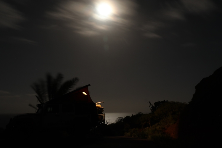
In the afternoon, we were again on the lookout for a possible place to camp for the night. But it was just too steep for our needs. Everywhere it would have been possible, there were houses or banana plantations and thus we would have set up our camp on private ground. But far up in the forests around the mighty basin of the “Caldera de Taburiente”, we kept finding cosy spots where we spent very quiet nights. Due to the altitude, we had to activate our heating again and again, which is almost unusual for the Canary Islands, to avoid freezing to death. But we had a lot of peace and quiet and mostly a wonderful starry sky, where one shooting star after the other glowed and gave us many wishes.
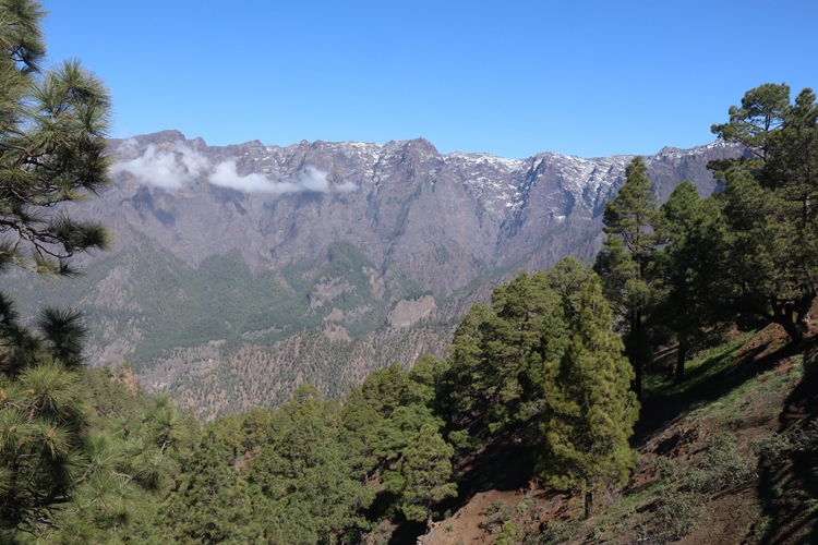
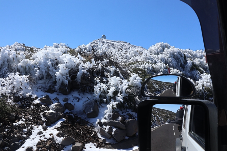
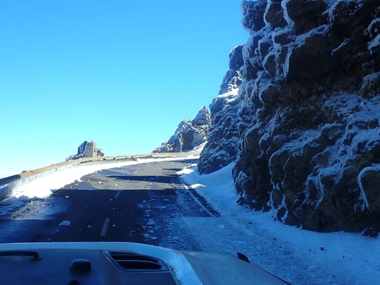
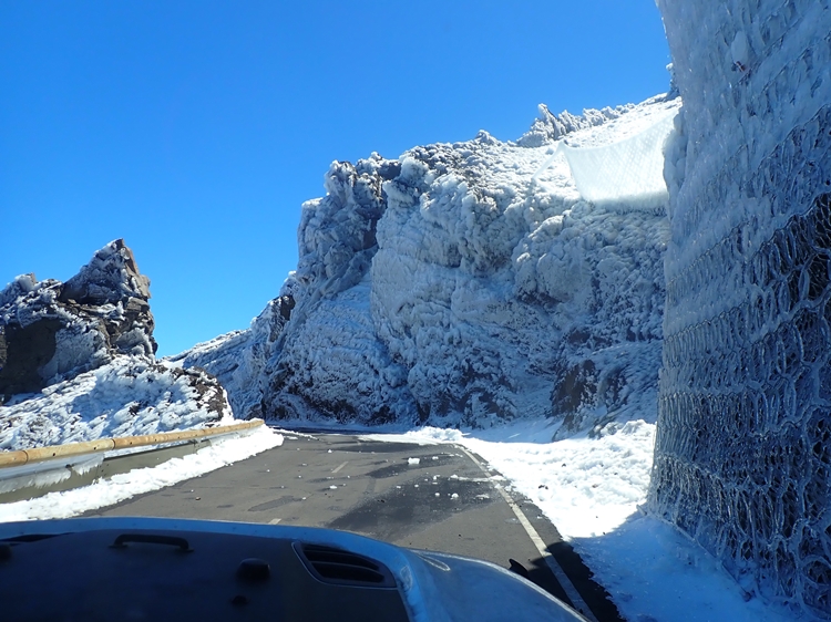
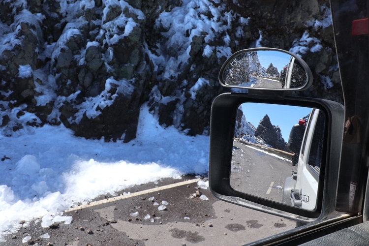
Due to the strong storm that had swept over the island a few days before and had brought low temperatures with it, there was snow on the edge of the “Caldera de Taburiente”. The ice formations on the rock structures gave the mountain landscape an enchanting appearance and invited us to linger; but the cold soon drove us back down to the banana plantations.
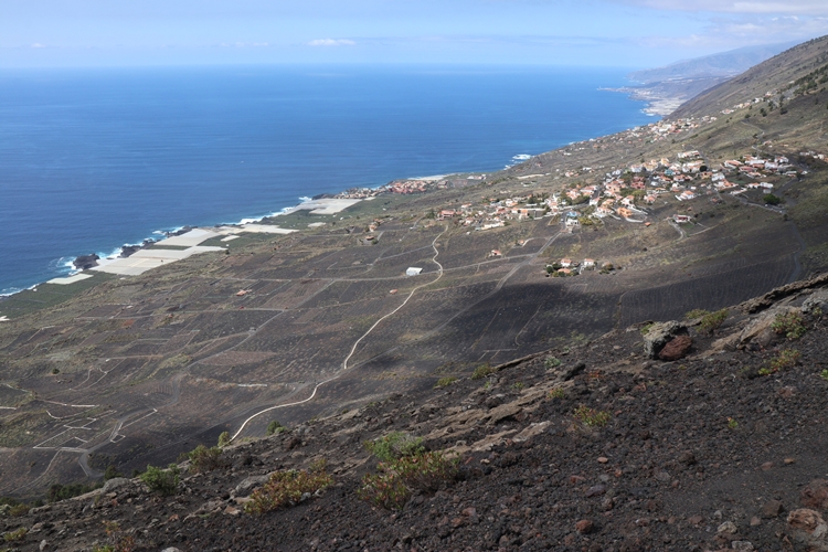
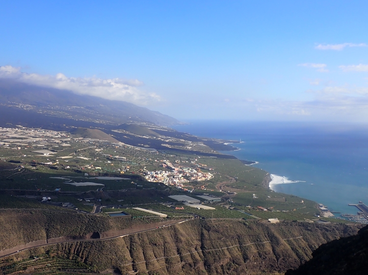
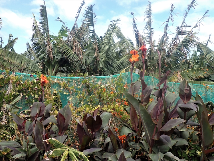
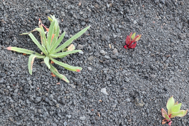
The northern side of the island is covered with a dense jungle and only a few places cling to steep rocky ridges. In a few bays, there are isolated banana crops, most of which gave us a somewhat dilapidated impression. Maybe the banana business is not so lucrative after all and the young people are looking for their fortune elsewhere. Or is it the remoteness, so that with our “mustn’t cost anything” mentality and constantly falling world market prices, it is no longer worth taking on the arduous work in the plantations?
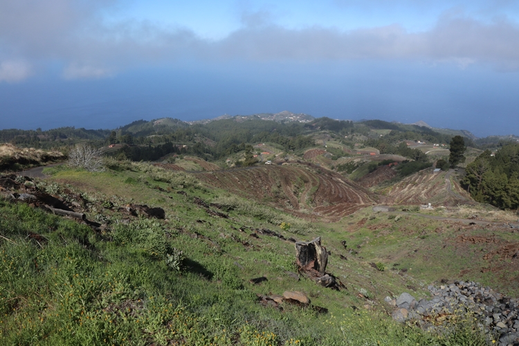
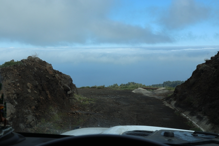
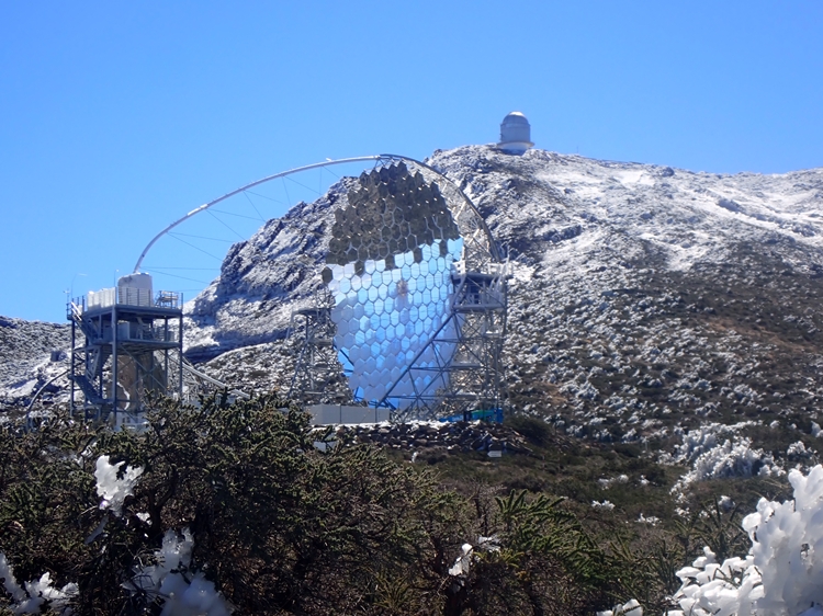
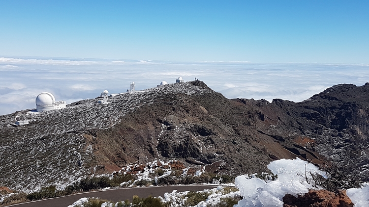
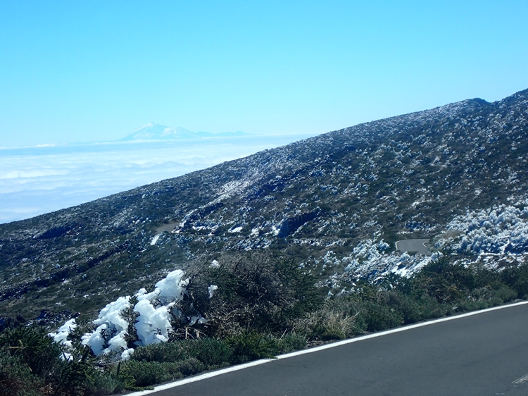
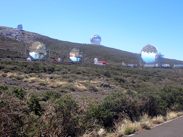
After another night far up in the deep pine forest, where fog and rain accompanied us through the night, we dared to climb up to the roof of La Palma again the following morning, i.e. up to the “Roque de las Muchachos” again, where the world’s largest astronomical research centre in the northern hemisphere is located. Our way led us through the dense forest; the past storm left its traces everywhere. The fog kept making us wonder whether we were on the right track and whether the other direction into the valley would have been better after all. At 1800 metres we were then convinced – it was the right decision: a bright blue sky and an infinitely wide sea of fog surprised us beyond all measure.
Unfortunately, this wonderful weather was only of very short duration and again thick clouds moved over the island from the north. Humidity and the fresh wind made our adventurous spirit slacken a bit and we were glad to know a good sheltered place at the southern tip where we could wait for the return date to Tenerife and I could lace up my hiking boots once more.
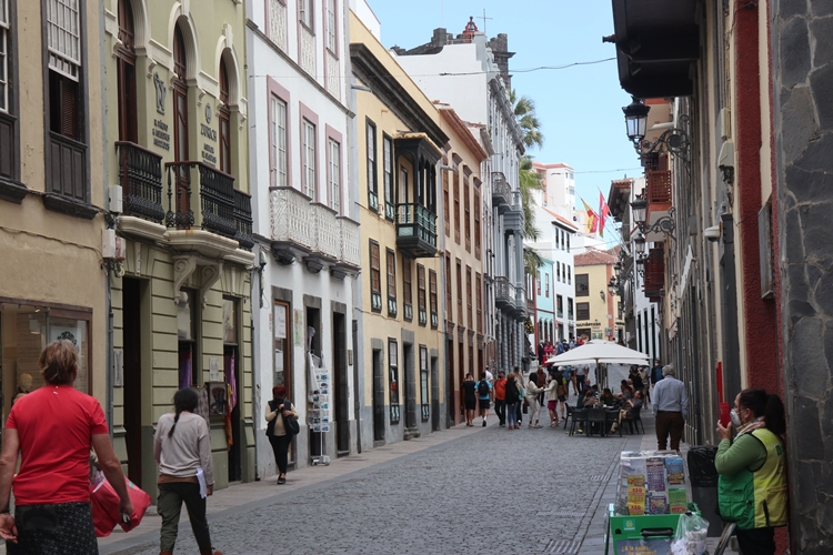
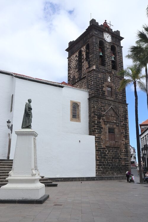
Soon our days were numbered and we headed back along the east coast to Santa Cruz de la Palma. The late ferry connection to Tenerife still allowed us to stroll the streets of this beautiful town, which clings to the narrow coastal strip between the sea and the steep slopes of the mountains behind.
The evening fast ferry soon strode out to sea and towards Tenerife, where there will be a short stopover before the big journey back to the mainland. So; we hope for a pleasant journey and calm seas!


>Translated with www.DeepL.com/Translator