Tag: Jeep Tour

From zero to 4800 and back to zero

>Translated with www.DeepL.com/Translator
(>Pictures at the bottom!)

The Fitz Roy (granite mountain) waved goodbye to us a little bashfully and soon it disappeared in our rear-view mirror. For us, as well as the whole group, we continued northwards on the “Panamericana”. Whether it really is this dream road or not is beyond my knowledge. Here in southern America, people argue about strange things, e.g. who invented pisco (brandy) or where exactly the potato comes from. It’s no different with the “Panamericana”; every country thinks it has the original. Read More

Final sprint home….

>Translated with www.DeepL.com/Translator
(>Pictures at the bottom!)

Madrid – Andorra – France – Switzerland
We enjoyed the last evening in Madrid with a fine wine, drew another straight line on the electronic map in the direction of Andorra and were already dreaming of the further eventful paths and tracks off the tarmac. Others drive as fast as possible, we will look for the straightest way and thus venture into somewhat more unknown areas. Read More

On the way home…

>Translated with www.DeepL.com/Translator
(>Pictures at the bottom!)

….from Huelva via Portugal to Madrid
The April weather had already caught up with us when we docked at the ferry; the clouds hung low and a few raindrops slapped on the windscreen. Well, there would be no pleasant warmth and sunshine in southern Spain and Portugal. Although the weather forecasts predicted rather wet days, we ventured “cross-country” in the direction of Portugal. Read More

La Palma

>Translated with www.DeepL.com/Translator
(>Pictures at the bottom!)

This island, far out in the Atlantic, is the greenest of all the Canary Islands. In the north are lush forests that stretch far up into the mountains, while the south is dry and volcanic activity is still active to this day. In 2021, an entire stretch of land, a village with its agglomeration and extensive banana crops west of “Cumbre Vieja” were buried under lava and ash.
In former times, i.e. in the times after the discovery of America, La Palma was an important place, and the Canary Island pines also provided the best wood for shipbuilding. Trade, special laws in connection with the Atlantic crossing and the former sugar cane cultivation brought considerable wealth to the islands and its inhabitants, which can still be experienced today in Santa Cruz de la Palma and other places.
Today, things are a little quieter on La Palma than they were at the time of the great voyages of discovery. Since there are hardly any beaches with mass tourism, you can quickly find your peace and quiet on the extensive network of hiking trails or get lost on some forest road. Read More

La Gomera

>Translated with www.DeepL.com/Translator
(>Pictures at the bottom!)

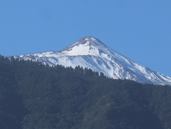
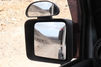
The island rises out of the Atlantic like an impregnable fortress, and steep walls greet arrivals from afar. The traffic routes are narrow and wind along the rock faces, climbing steeply uphill or dropping almost in the fall line. The houses often cling to rocky peaks in the most impossible places, and the former volcanic activity is present everywhere.
As there is no infrastructure for mass tourism anywhere, there are also no masses of people looking for recreation, and life is approached very calmly by the local population. In addition to the laid-back population, more and more mainland Europeans are settling in La Gomera and enjoying the island’s unique climate. Sunshine can be followed by thick clouds within minutes, accompanied by a lot of wind and humidity; rain is usually followed by sunshine again. On the south side, the island is drier and irrigation systems provide enough water.
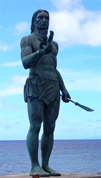
The island’s capital San Sebastián has the flair of a village, and people know each other. If you leave the town on one of the few arterial roads, it becomes even quieter and you can safely shift down a gear or two and relax.
In the heart of La Gomera lies the “Parque Nacional de Garajonay”, which covers around 10% of the island’s surface with an almost impenetrable laurel forest and rises to almost 2000 metres. Besides its important function in the ecosystem, this forest, or rather the whole island, is a true Eldorado for hikers. Read More

Going to Tenerife

>Translated with www.DeepL.com/Translator
(>Pictures at the bottom!)

Gran Canaria is not the largest island of the Canary archipelago; besides Fuerteventura, Tenerife is also much larger and, compared to Fuerteventura, very mountainous. The mountains run through the middle of the island and rise to a high plateau of over 2000 metres, where a few million years ago the Pico del Teide grew to 3718 metres in a massive eruption and is now the highest mountain in Spain. Snow, storms and wintry conditions are nothing unusual around Teide and the summit climb can be closed for weeks.
Surrounding the Teide National Park is the “Parque Natural de Corona Forestal”, which lies like a collar around the Teide and covers a very large area of the island with a pine forest. Immediately following and to the north-east is the wild area of the “Parque Rural de Anaga”.
The north and north-west coasts are favoured with a lot of humidity and allow the vegetation to flourish in all its varieties. It is also the area where most people on the island have settled and cultivate other agricultural products besides bananas.
Actually, everything on Tenerife is steep to very steep; from the highest elevations, the slopes often reach down to the sea. The roads wind along the slopes, climb steeply uphill or fall almost in the fall line towards the sea.
The many tourist facilities are to be found on the south-west as well as the south coast, where people enjoy the sun on the few kilometres of beach or take advantage of the many other offers of the tourist industry. So it is not surprising that next to abandoned banana plantations there are hotel complexes as if from a thousand and one nights, followed by countless ruined buildings and…. a bit of rubbish everywhere! Read More

The next move…

>Translated with www.DeepL.com/Translator
(>Pictures at the bottom!)

…the return journey to Fuerteventura and Gran Canaria.
Lanzarote was a wonderful island, but we never really fell in love with it. Was it because of its size, or the population? Or was it the constant wind that made life difficult for us during some nights? We don’t know for sure! On the other hand, we felt right at home as soon as we arrived on our return trip to Fuerteventura and, although we had already experienced many things on it, we set off for further adventures straight away. The relatively sparse population, the vast landscapes without any houses and the desert-like appearance inspired us again. Read More

Offroad

>Translated with www.DeepL.com/Translator
(>Pictures at the bottom!)

…gravel roads on Fuerteventura
Since Morocco has been practically untravellable for individual tourists since 2 years, we looked for our desert experiences on the Canary archipelago to the west. And, on Fuerteventura we were more than surprised. Compared to the other Canary Islands, Fuerteventura has a somewhat different image due to its long volcanic history, and the landscape is often reminiscent of areas bordering or lying in the Sahara. In addition to Spanish traffic laws, there are also the tourist considerations, so that not everything was immediately banned. Thus, whole groups of tourists are guided with their ATVs and quads on approved trails through nature parks or areas worthy of protection. These routes are of course also open to individual travellers with their vehicles. Outside the regional and nature parks, which actually applies to the whole of Spain, all passable paths may be used where this is not expressly forbidden or the landowner does not permit it. In national parks, on the other hand, the restrictions are very restrictive and monitored accordingly. Read More

Island hopping

>Translated with www.DeepL.com/Translator
(>Pictures at the bottom!)

Fuerteventura and Lanzarote
Fuerteventura is considered the oldest island of the Canary archipelago and, like Lanzarote, very desert-like. In places you even have the impression of moving through a lunar landscape. The volcanic activity in the past is omnipresent. After fine volcanic ash, you bump over hardened lava fields and follow the former lava flow towards the sea, where the surf has already left its deep traces after thousands of years.
It is also very astonishing that peoples from North Africa settled here a very long time ago and were able to extract the necessities of life from the barren soil. Thanks to the few water sources and streams, they were able to plant the bare necessities on the very fertile volcanic soil, and their success led to regular raids of the islands in prehistoric times.
Today, piracy is over, but without irrigation, most crops would wither in no time. Human help is omnipresent for the palms or other plants. Groundwater extraction led to the lowering of the water table in many places. The many defective, collapsed and old water pumps that are at the mercy of their fate are probably a clear indication of this.
Besides the irrigation of agricultural crops, tourism also has a great “thirst for water”, which is provided thanks to desalination plants and thermal power plants provide the necessary power. A vicious circle! Read More